MAPPING FINAL SERIES
"The art of mapping seeks to chart not just places or even abstract territories, but the ideas and concerns we attach to cartography itself."---Paula Scher
In my understanding, the definition of mapping is not just making a graph that shows where we are, giving our direction and information of surrounding, but mapping the concerns and history within the area.
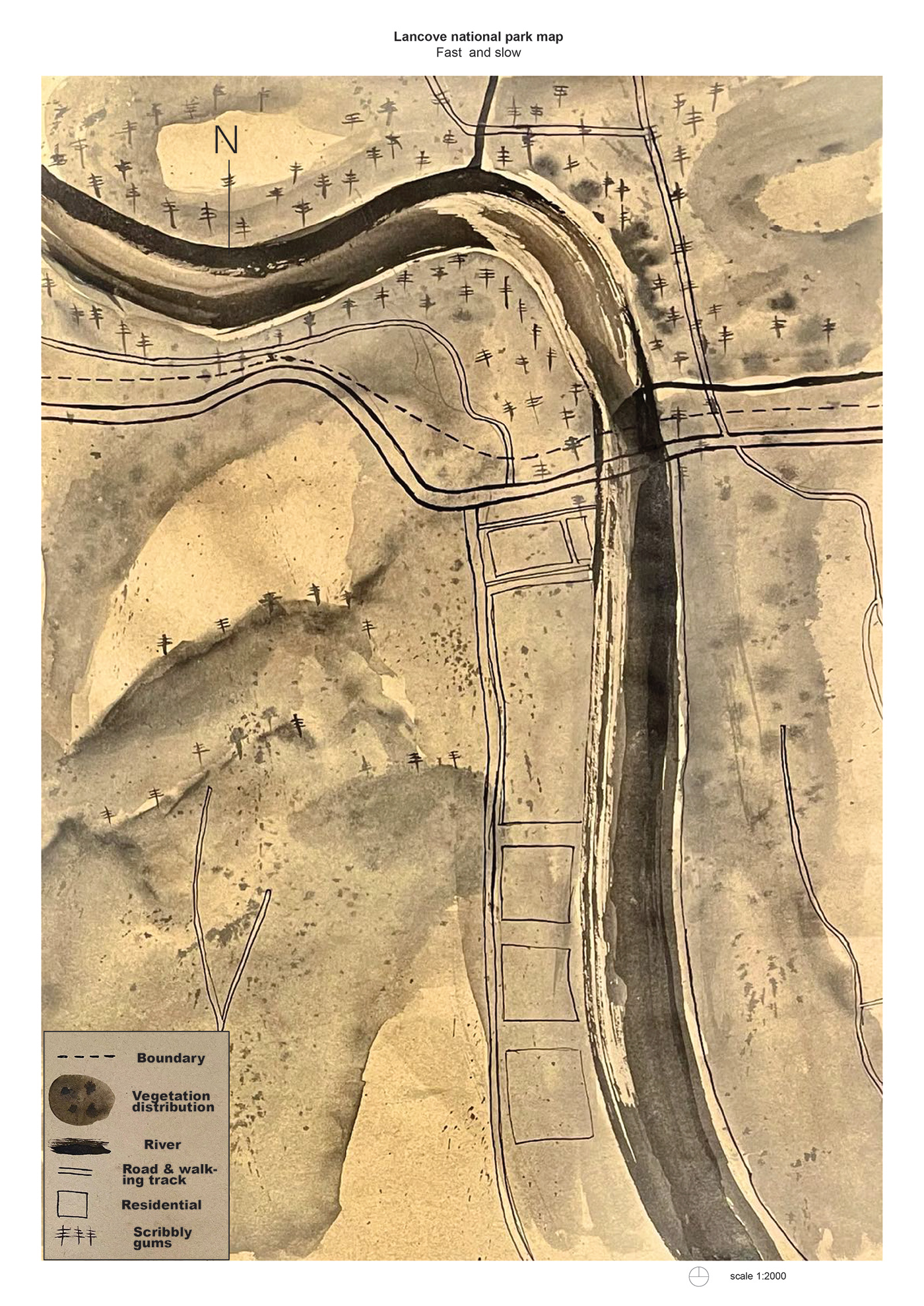
My final docs are aimed at investigating the close relationship between the nature and human civilization. In order to communicated this idea, I have chosen to map the layer of vegetations and arterial roads to enhance the water layer so that I could investigate how and why the water system drive human development. During researching and thinking, I find that roads and water they have one thing in common which is connectivity. They all have the function of transportation, which allow resource complementation
I chose to look at lane cove river In my 1:2000 scale drawings, It’s located in lane cove national park, which is also a part of Chatswood west. This area was originally inhabited by the Cam-mer-ray-gal Group of the Ku-ring-gai Aboriginal Tribe. The group, which inhabited the north shore of Port Jackson , was one of the largest in the Sydney area.
In my drawing, I have used ink on kraft paper to map the river in fast and slow, in order to illustrate this, I used a technique ‘fast and slow’ to create the different brush strokes which will be use to represent the speed of the river. For vegetation layer I used technique ‘wet on wet’, in which I brushed the first layer with water and then spread droplets of ink on the surface before the water dry out. In doing so the diffused ink drops will create a sense of densely wooded area.

ITERATION 1:


ITERATION 2:


ITERATION 3:


ITERATION 4:


